Mapas de España
Free Version
Publisher Description

Mapas de España - Ideal for hiking, biking display, running or skiing, etc
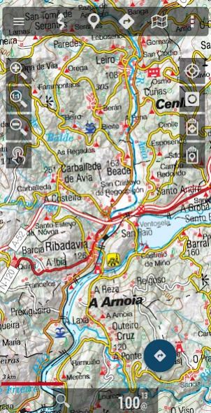
Free viewer ideal for hiking, cycling, running or skiing, which uses as background cartography the services of the National Geographic Institute and another set of services from other Ministries, such as the Cadastral information of the plots provided by the General Directorate of Cadastre.
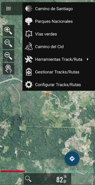
With this application you can travel the routes of the National Parks or the stages of the Camino de Santiago or use your TRACKS/ROUTES, plan excursions using maps, navigation and guided tours, without having to have an internet connection.
All maps and routes used are free and allow you to:
- GPS location, even without mobile coverage
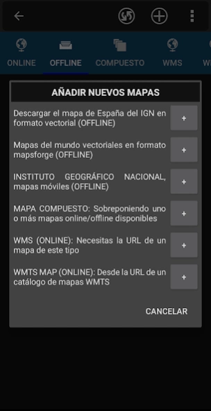
- Offline map mode*: save them in advance
- Trace routes (Tracks) with GPS on the maps of the National Geographic Institute.
- Save and view tracks in gpx or kml and kmz format.
- Supports IGN's WMS and WMTS map services, you can use the application as a WMS viewer
- Use the services of the CartoCiudad project to locate places
- Positioning visualization using coordinates, heading, speed, altitude. Distance calculation
- The application is available in Spanish, Catalan, Galician, Basque and English.
- Based on OruxMaps software.
Maps of Spain is used as a GIS tool, comes from a Spanish government department (https://www.ign.es/web/ign/portal) and is used by professionals of various types, including workers of the Spanish State (police, forest guards, firefighters...)
It is common to have the catalog of maps of Spain in internal storage. For example, databases, in mbtiles format:
https://centrodedescargas.cnig.es/CentroDescargas/loadMapMov.do
It is not possible to move all that information to the private storage of each app that wants to use that data (we are talking about tens or hundreds of gigabytes). And from public storage, using the Android file access system, direct and random access to files is not allowed, which is required by the app to access databases or binary map formats.
Without this permission, professional and non-professional users who regularly use the app as a GIS will not be able to continue using the app as needed.
Identification Number of Official Publications (NIPO): 162190330
About Mapas de España
Mapas de España is a free app for Android published in the Recreation list of apps, part of Home & Hobby.
The company that develops Mapas de España is Centro Nacional de Información Geográfica - CNIG. The latest version released by its developer is 1.0.
To install Mapas de España on your Android device, just click the green Continue To App button above to start the installation process. The app is listed on our website since 2024-01-09 and was downloaded 1 times. We have already checked if the download link is safe, however for your own protection we recommend that you scan the downloaded app with your antivirus. Your antivirus may detect the Mapas de España as malware as malware if the download link to com.orux.oruxmapsIGN is broken.
How to install Mapas de España on your Android device:
- Click on the Continue To App button on our website. This will redirect you to Google Play.
- Once the Mapas de España is shown in the Google Play listing of your Android device, you can start its download and installation. Tap on the Install button located below the search bar and to the right of the app icon.
- A pop-up window with the permissions required by Mapas de España will be shown. Click on Accept to continue the process.
- Mapas de España will be downloaded onto your device, displaying a progress. Once the download completes, the installation will start and you'll get a notification after the installation is finished.
